Posts

Es werden Posts vom April 6, 2024 angezeigt.

13 km W of Elche,-33 km WSW of Alicante-2.3

Magnitude 2.3 Region SPAIN Date time 2024-04-06 19:16:36.7 UTC Location 38.283 ; -0.849 Depth 8 km Distance 33 km WSW of Alicante, Spain / pop: 334,000 / local time: 21:16:36.7 2024-04-06 13 km W of Elche, Spain / pop: 230,000 / local time: 21:16:36.7 2024-04-06 Source parameters provided by: Instituto Geografico Nacional -- Madrid, Spain (IGN) Global view I felt this earthquake All data providers for this event: Instituto Geografico Nacional -- Madrid, Spain (IGN) Further information can be found at: Instituto Geografico Nacional -- Madrid, Spain (IGN)

ROMANIA-11 km SSW of Galaţi, Romania-3.3

Magnitude 3.3 Region ROMANIA Date time 2024-04-06 16:51:19.6 UTC Location 45.359 ; 27.970 Depth 10 km Distance 141 km NNW of Constanţa, Romania / pop: 303,000 / local time: 19:51:19.6 2024-04-06 11 km SSW of Galaţi, Romania / pop: 294,000 / local time: 19:51:19.6 2024-04-06 Source parameters not yet reviewed by a seismologist Global view I felt this earthquake All data providers for this event: National Institute for Earth Physics -- Bucharest, Romania (NIEP) EMSC - CSLOC -- Arpajon, France (CSLC) Further information can be found at: Geophysical Survey of the Russian Academy of Sciences -- Obninsk, Russia (GSRAS) Institute of Geophysics and Geology -- Chisinau, Moldova (MOLD) National Institute for Earth Physics -- Bucharest, Romania (NIEP)

Sonnenfinsternis am 8. April: Ist eine Katastrophe geplant?

Bild
https://youtu.be/D2yjqCWtyPI?si=wlDGLUq1N6qnjim3

⚠️ Problemas de meteo en espacio aéreo británico y demoras por seguridad.

Bild
😉Controladores Aéreos 🇪🇸 @controladores · 32m Info Eurocontrol: ⚠️ Problemas de meteo en espacio aéreo británico y demoras por seguridad. ⚠️ En #Barcelona y #Tenerife Norte procedimientos de Baja Visibilidad. Regulaciones por seguridad con previsión de Altas Demoras. https://public.nm.eurocontrol.int/PUBPORTAL/gate

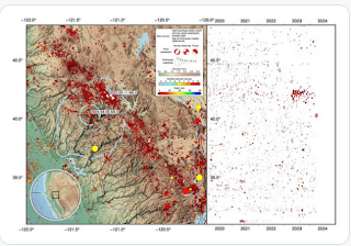
A map of yesterday's M4.5 earthquake in the Sierra Nevada.

Bild
Dr. Judith Hubbard @JudithGeology · 18h A map of yesterday's M4.5 earthquake in the Sierra Nevada. It occurred close to a M5.4 quake last May that we wrote about on our blog. That earthquake produced quite a lot of aftershocks, but the recent M4.5 was on a different fault to the SW.