Posts

Es werden Posts vom August 23, 2014 angezeigt.

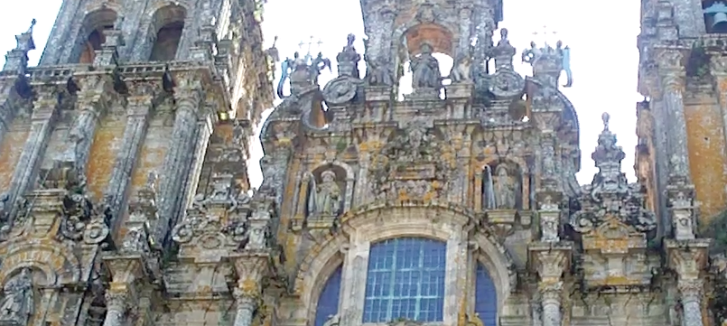
Galicien: Santiago de Compostela-Wird Wirtschaftsminister Luis de Guindos die Präsidentschaft der Eurogruppe bekommen?

Bild
Die Zeit drängt angesichts der fatalen Schulden-Situation Spaniens. Die Staatsschulden in Spanien haben erstmals die Schwelle von einer Billion Euro überschritten.    Aber das ist im Moment wohl nur der sekundäre Grund, warum sich Ministerpräsident , Mariano Rajoy und Bundeskanzlerin Angela Merkel in Santiago de Compostela (Galicien), dem Geburtsort von Mariano Rajoy, treffen. Noch vor dem Zusammenschluss des Europäischen Rat in Brüssel am 30. August An diesem Datum gibt es einen Sondergipfel für eine Benennung einer neuen Besetzung von Leitern der EU.  Das ist das eigentliche Thema der leitenden europäischen Union ,  einschließlich der Präsidentschaft der Eurogruppe , wo als Favorit der spanische Wirtschaftsminister Luis de Guindos auserwählt wurde,- für die starke Abteilung, die besonders konfrontative östlichen Ländern managen soll. Zudem wird der Ministerpräsident die Möglichkeit nutzen, während eines persönlichen Gesprächs mit der Bundeskanzlerin ,

ICELAND-4.7

Bild
Magnitude mb 4.7 Region ICELAND Date time 2014-08-23 18:33:06.2 UTC Location 64.70 N ; 17.48 W Depth 2 km Distances 222 km E of Reykjavík, Iceland / pop: 113,906 / local time: 18:33:06.2 2014-08-23 113 km S of Akureyri / pop: 16,563 / local time: 18:33:00.0 2014-08-23 Source parameters not yet reviewed by a seismologist More information at:   Department of Geophysics, Icelandic Meteorological Office Reykjavik, Iceland

FRANCE-2.9

Bild
Magnitude ML 2.9 Region FRANCE Date time 2014-08-23 10:45:17.3 UTC Location 49.57 N ; 1.55 W Depth 2 km Distances 59 km NE of Saint Helier, Jersey / pop: 28,000 / local time: 11:45:17.3 2014-08-23 4 km NE of Brix, France / pop: 1,984 / local time: 12:45:17.3 2014-08-23 Source parameters provided by:   Laboratoire de Détection et de Géophysique -- Bruyères-le-Châtel, France (LDG) More information at:   Laboratoire de Détection et de Géophysique Bruyères-le-Châtel, France   Réseau National de Surveillance Sismique Strasbourg, France   Bureau Central Sismologique Francais (BCSF) Strasbourg, France   Plan Séisme ( Information sur les bons gestes à appliquer en cas de séisme )

Galicien-ZAS.C-2.0

Bild
Evento Fecha Hora (GMT)* Latitud Longitud Prof. (km) Int. (***) Máx. Mag. Tipo (**) Mag. Localización 1291307 23/08/2014 09:05:20 43.0889 -8.8870 15   2.0 4 SE ZAS.C

LUPIÓN.JAÈN-2.5-1.8

Bild
Evento Fecha Hora (GMT)* Latitud Longitud Prof. (km) Int. (***) Máx. Mag. Tipo (**) Mag. Localización 1291332 23/08/2014 12:46:41 37.9819 -3.5768     2.5 4 SW LUPIÓN.J Evento Fecha Hora (GMT)* Latitud Longitud Prof. (km) Int. (***) Máx. Mag. Tipo (**) Mag. Localización 1291321 23/08/2014 12:30:40 37.9878 -3.5631     1.8 4 SW LUPIÓN.J Magnitude ML 2.5 Region SPAIN Date time 2014-08-23 12:46:41.2 UTC Location 37.98 N ; 3.58 W Depth 10 km Distances 258 km NE of Gibraltar, Gibraltar / pop: 26,544 / local time: 14:46:41.2 2014-08-23 212 km S of Toledo, Spain / pop: 82,291 / local time: 14:46:41.2 2014-08-23 30 km NE of

MONTELLANO.SEVILLA-1.7

Bild
Evento Fecha Hora (GMT)* Latitud Longitud Prof. (km) Int. (***) Máx. Mag. Tipo (**) Mag. Localización 1291303 23/08/2014 08:43:29 36.9833 -5.5589 8   1.7 4 SE MONTELLANO.SE

Katalanische Bauern zünden EU Flagge mit Pfirsischen an-Agricultores de Cataluña queman la bandera de la UE en una hoguera de me...

Obst und Milchbauern in Katalonien haben aus  Protest die Flagge der Europäischen Union in einem Schwelbrand mit ihren geernteten Pfirsichen in der Nähe eines Gebäudes der Stadt Lleida in West Katalonien angezündet. Der Protest wurde von Hunderten von Obst und Milch wütend durchgeführt. Die lehnen  die Bedingungen und Lebensweise der EU- Entscheidungen, die auf das russische Veto zurückzuführen sind, haben dieseses Ergebniss. Ernten werden vernichtet und die Europäische Lebensmittelversorgung wankt durch die Gesetzgebung der EU.

Es rumort im Berg: Erdbeben am isländischen Bardabunga-Vulkan

Der isländische Bardarbunga ruht, aber er wälzt sich immer unruhiger im Schlaf. In den vergangenen Tagen haben Geologen vermehrt Erdbeben mit einer Stärke von bis zu 4,0 auf der Richterskala verzeichnet - die Epizentren liegen Kilometer unter dem Berg. Zuletzt war der Vulkan 1996 aktiv. Wie genau sich die Gewalten in der Erdkruste verhalten werde, lässt sich nicht vorhersagen: "Wir müssen darauf vorbereitet sein, dass alles sehr schnell geht und das Magma zur Oberfläche aufsteigt. Aber das Mag… LESEN SIE MEHR: http://de.euronews.com/2014/08/22/es-...

Das Wetter-Regenfluten im Norden überstanden!

Bild
Der Regen im Norden von Spanien wurde gebraucht. Die Sonne zaubert neue Blüten hervor. Ein zweiter Frühling erwacht. Der Herbst im Norden ist wie ein zweiter Frühling, wenn es genügend geregnet hat.

IRAN-IRAQ BORDER REGION-5.3-3.6-4.2

Bild
Magnitude mb 5.3 Region IRAN-IRAQ BORDER REGION Date time 2014-08-22 20:06:02.2 UTC Location 33.44 N ; 45.74 E Depth 10 km Distances 125 km E of Baghdad, Iraq / pop: 5,672,513 / local time: 23:06:02.2 2014-08-22 67 km W of Īlām, Iran / pop: 140,940 / local time: 00:36:02.2 2014-08-23 38 km SE of Mandalī, Iraq / pop: 29,785 / local time: 23:06:02.2 2014-08-22 Source parameters reviewed by a seismologist Magnitude ML 3.6 Region IRAN-IRAQ BORDER REGION Date time 2014-08-23 00:50:39.2 UTC Location 33.68 N ; 45.50 E Depth 10 km Distances 109 km E of Baghdad, Iraq / pop: 5,672,513 / local time: 03:50:39.2 2014-08-23 80 km E of Ba‘qūbah, Iraq / pop: 152,550 / local time: 03:50:39.2 2014-08-23 9 km SW of Mandalī, Iraq / pop: 29,785 / local time: 03:50:39.2 2014-08-23 Source parameters provided by: Magnitude ML 4.2 Region IRAN-IRAQ BORDER REGION Date time 2014-08-23 04:57:58.3 UTC Location 32.73 N ; 47.45 E Depth 2 km Distances 246 km N of Al Başrah, Iraq /

TARAPACA, CHILE-5.6

Bild
Magnitude Mw 5.6 Region TARAPACA, CHILE Date time 2014-08-23 04:45:32.6 UTC Location 20.13 S ; 68.82 W Depth 93 km Distances 392 km W of Sucre, Bolivia / pop: 224,838 / local time: 00:45:32.6 2014-08-23 139 km E of Iquique, Chile / pop: 227,499 / local time: 00:45:32.6 2014-08-23 Source parameters not yet reviewed by a seismologist More information at:   Universidad de Chile, Dep. de Geofisica , Chile   USGS/NEIC Denver, USA   GeoForschungsZentrum (GEOFON) Potsdam, Germany

CYPRUS REGION-3.4

Bild
Magnitude Mw 3.4 Region CYPRUS REGION Date time 2014-08-23 02:40:03.0 UTC Location 35.42 N ; 31.52 E Depth 2 km Distances 170 km W of Nicosia, Cyprus / pop: 200,452 / local time: 05:40:03.0 2014-08-23 109 km NW of Paphos, Cyprus / pop: 35,961 / local time: 05:40:03.0 2014-08-23 93 km NW of Polis, Cyprus / pop: 1,975 / local time: 05:40:03.0 2014-08-23 Source parameters not yet reviewed by a seismologist More information at:   Disaster and Emergency Management Presidency, Earthquake Department Ankara, Turkey   Kandilli Observatory and Earthquake Research Institute Istanbul, Turkey

AEGEAN SEA-2.9

Bild
Magnitude ML 2.9 Region AEGEAN SEA Date time 2014-08-23 00:52:56.1 UTC Location 39.91 N ; 23.48 E Depth 5 km Distances 215 km N of Athens, Greece / pop: 729,137 / local time: 03:52:56.1 2014-08-23 93 km SE of Thessaloníki, Greece / pop: 354,290 / local time: 03:52:56.1 2014-08-23 52 km S of Polýgyros, Greece / pop: 10,000 / local time: 03:52:56.1 2014-08-23 13 km S of Políkhronon, Greece / pop: 1,174 / local time: 03:52:56.1 2014-08-23 Source parameters not yet reviewed by a seismologist More information at:   National Observatory of Athens, Geodynamic Institute Athens, Greece   Department of Geophysics, University of Thessaloniki Thessaloniki, Greece   University of Patras, Seismological Laboratory Patras, Greece

CRETE, GREECE-3.1

Bild
Magnitude ML 3.1 Region CRETE, GREECE Date time 2014-08-22 23:32:12.8 UTC Location 34.89 N ; 23.91 E Depth 2 km Distances 343 km S of Athens, Greece / pop: 729,137 / local time: 02:32:12.8 2014-08-23 122 km SW of Irákleion, Greece / pop: 137,154 / local time: 02:32:12.8 2014-08-23 70 km S of Chaniá, Greece / pop: 54,565 / local time: 02:32:12.8 2014-08-23 43 km SE of Palaiochóra, Greece / pop: 2,372 / local time: 02:32:12.8 2014-08-23 Source parameters not yet reviewed by a seismologist More information at:   Technological Educational Institute of Crete, Seismological Network of Crete Chania, Greece   National Observatory of Athens, Geodynamic Institute Athens, Greece   Department of Geophysics, University of Thessaloniki Thessaloniki, Greece   University of Patras, Seismological Laboratory Patras, Greece

SICILY, ITALY-2.5

Bild
Magnitude ML 2.5 Region SICILY, ITALY Date time 2014-08-22 22:55:49.3 UTC Location 38.95 N ; 15.17 E Depth 282 km Distances 343 km N of Valletta, Malta / pop: 6,794 / local time: 00:55:49.3 2014-08-23 124 km W of Catanzaro, Italy / pop: 95,251 / local time: 00:55:49.3 2014-08-23 86 km W of Vibo Valentia, Italy / pop: 33,957 / local time: 00:55:49.3 2014-08-23 Source parameters provided by:   Instituto Nazionale di Geofisica e Vulcanologia -- Roma, Italy (INGV) More information at:   Italian National Seismic Network Roma, Italy